The Global Positioning System (GPS) is a satellite-based navigation system owned by the United States government and operated by the United States Space Force[1]. Here’s a comprehensive overview of GPS:
Overview and History
GPS was developed by the U.S. Department of Defense in 1973, with the first prototype spacecraft launched in 1978. The full constellation of 24 satellites became operational in 1993[1]. Initially, civilian use was limited to an average accuracy of 100 meters due to Selective Availability (SA), which was disabled in 2000 by President Bill Clinton[1].
The system’s development was driven by military needs, particularly for accurate positioning of submarines carrying nuclear missiles. However, it has since become an essential tool for both military and civilian applications worldwide[1].
Technical Aspects
GPS operates using a constellation of satellites in Medium Earth Orbit (MEO). Key technical details include:
- Constellation size: 24 nominal satellites, with 38 currently usable (32 operational)[1]
- Orbital characteristics:
- Height: 20,180 km (12,540 mi)
- Period: 11 hours and 58 minutes
- Planes: 6 MEO planes[1]
- Accuracy: 30–500 cm (0.98–16 ft)[1]
- Coverage: Global[1]
The system works by having GPS receivers on Earth calculate their position by precisely timing signals sent by the GPS satellites. At least four satellite signals are needed to compute positions in three dimensions and the time offset in the receiver clock[1].
Applications
GPS has a wide range of applications across various sectors:
- Military: Navigation, target tracking, missile guidance
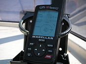
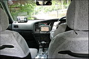
- Civilian navigation: Car navigation systems, smartphone apps
- Surveying and mapping
- Agriculture: Precision farming
- Aviation: Flight planning, approach, and landing
- Maritime: Ship navigation and port approaches
- Emergency services: Location of emergency calls, search and rescue operations
- Time synchronization: Financial transactions, cellular networks
- Scientific research: Atmospheric studies, geodesy
System Components
GPS consists of three main segments:
- Space Segment: The satellite constellation
- Control Segment: Ground stations monitoring and controlling the satellites
- User Segment: GPS receivers used by end-users
Modernization and Future Development
GPS is continuously being modernized to improve its accuracy, reliability, and resistance to interference. Key developments include:
- GPS III satellites: Launched from 2018, offering improved accuracy and stronger signals[1]
- New civilian signals: L2C, L5, and L1C for enhanced performance
- Next Generation Operational Control System (OCX): Improved ground control segment
Economic Impact
GPS has had a significant economic impact:
- Initial constellation cost: $12 billion
- Annual operating cost: $1.84 billion (2023)[1]
- Estimated annual benefit to the U.S. economy: Over $300 billion
International Context
While GPS is the most widely used GNSS, other countries have developed or are developing their own systems:
- Russia: GLONASS
- European Union: Galileo
- China: BeiDou
- India: NavIC
- Japan: QZSS (regional system)
Many modern receivers can use multiple GNSS systems for improved accuracy and reliability.
Limitations and Challenges
Despite its widespread use, GPS faces several challenges:
- Signal attenuation: Weak signals can be blocked by buildings, mountains, or dense foliage
- Multipath errors: Signals reflected off surfaces can cause positioning errors
- Ionospheric effects: The ionosphere can delay GPS signals, affecting accuracy
- Intentional jamming or spoofing: Potential security threats
- Reliance on a single nation’s system: Geopolitical concerns
In conclusion, GPS has revolutionized navigation and timing services worldwide, with applications spanning military, civilian, and scientific domains. Its ongoing modernization and integration with other GNSS systems continue to improve its capabilities and importance in our daily lives[1].
[glossary_wikipedia]
The Global Positioning System (GPS), originally Navstar GPS, is a satellite-based radio navigation system owned by the United States government and operated by the United States Space Force. It is one of the global navigation satellite systems (GNSS) that provide geolocation and time information to a GPS receiver anywhere on or near the Earth where there is an unobstructed line of sight to four or more GPS satellites. It does not require the user to transmit any data, and operates independently of any telephone or Internet reception, though these technologies can enhance the usefulness of the GPS positioning information. It provides critical positioning capabilities to military, civil, and commercial users around the world. Although the United States government created, controls and maintains the GPS system, it is freely accessible to anyone with a GPS receiver.
 Logo | |
| Country/ies of origin | United States |
|---|---|
| Operator(s) | US Space Force |
| Type | Military, civilian |
| Status | Operational |
| Coverage | Global |
| Accuracy | 30–500 cm (0.98–16 ft) |
| Constellation size | |
| Nominal satellites | 24 |
| Current usable satellites | 38 (32 operational) |
| First launch | February 22, 1978 |
| Total launches | 75 |
| Orbital characteristics | |
| Regime(s) | 6 MEO planes |
| Orbital height | 20,180 km (12,540 mi) |
| Orbital period | 1⁄2 sd or 11 hours and 58 minutes |
| Revisit period | 1 sidereal day |
| Other details | |
| Cost | $12 billion (initial constellation) $1.84 billion per year (2023) (operating cost) |
| Website | gps.gov |


